|
Starr County
Cemeteries
If you have any information regarding
cemeteries in Starr County please consider sharing with others - locations,
photographs, partial or full surveys of burials....or if you know of
a website with information on a cemetery, please share that with me
- [email protected]
Great new list of
cemeteries, directions, locations, photos and maps with cemeteries located
donated to the site by David
Moreno!!! Thank you David.....
Link to a .pdf file that David
Moreno provided for our use that includes information below plus maps &
more. Great resource if you are researching Starr County Cemeteries.
It's a large file.
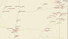
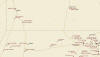
New Link to map that David will be updating - posted 23 Jan 2012
| Map 1 |
Map 2 |
Map 3 |
Map 4 |
Map 5 |
Map 6 |
Map7 |
 |
 |
 |
 |
 |
 |
 |
|
Name |
Road |
City or Town |
Location |
Off Site Links |
|
Agua Dulce |
Loma Blanca Road |
Las Escobas |
26.41.02.100 N
|
98.58.02.000 W
|
 |
|
Directions to cemetery: from intersection of US83 and Fm
2098 (southeast of Falcon State Recreation Area), travel
north on US83 2.6 miles; turn right/northwest on Loma Blanca
Road, travel north 16.5 miles; turn right/east onto access
road (dirt); cemetery is 100 meters east. |
|
Alcazar Graves |
135 Old US Hwy 83 west |
Rio Grande City |
26.22.34.901 N
|
98.50.09.433 W |
|
|
Driving Directions: From US 83 in Rio Grande City, go 0.3
mile southwest on Old US HWY 83 west. Cemetery is on left
(southeast) side of road beside house at 135 Old US HWY
83 W. This cemetery is highly endangered. It is not a map
feature, and it is located on private property. The cemetery
consists of two graves that are marked with locally cast
concrete slabs. There are no inscriptions or dates. The
graves are not fenced, and the markers have been damaged.
|
|
Arturo de la Garza Family
|
El
Remolino Rd, US 83 |
Rosita, Roma |
26.23.28.731 N
|
98.54.28.416 W |
|
|
Driving Directions: From US 83/FM 3167 junction in Rio Grande
City, go 3.2 miles west on US 83. Turn right onto El Remolino
Rd. and go 0.3 mile north. Cemetery is in field, approx.
407 ft. east of road. This is a well maintained, fully fenced,
active cemetery. It is not a map feature, and there are
no cemetery signs posted. The cemetery is located on private
property and is not accessible to the public. The cemetery
has a unique memorial marker dedicated to Garza Family ancestors.
There is also a unique Stone carving of an angel and Jesus
Christ adorning one marble grave marker. |
|
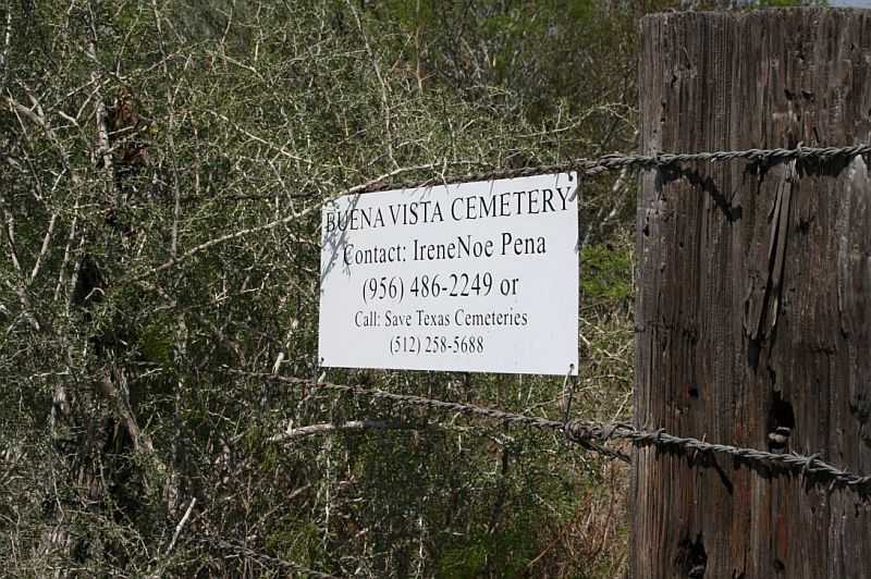
Buena Vista |
Loma
Blanca Rd, San Roman Rd |
Las
Escobas |
26.42.35.505 N
|
98.57.08.120 W
|
 |
|
Driving Directions: From
intersection of US 83 and FM 650 (southwest of Falcon State
Recreation Area), travel north on US 83 2.6 miles; turn
right at Loma Blanca Rd. and go approx. 18.3 miles northwest
(1.6 miles north of Una de Gato Rd.). Turn right at gate
(a cemetery sign is posted on gate) just before cattle guard
and go 0.2 mile east. At fork, turn right and go 0.1 mile
to cemetery. The cemetery is highly endangered. It is a
map feature, but it is located in a remote area on private
property. The cemetery is fully fenced, but not maintained.
There is a cemetery sign with contact information posted
on gate at Loma Blanca Rd. There are at least seven marked
graves and possibly some unmarked graves. Cemetery features
include locally cast concrete, formal marble, hand-wrought
Steel, and a homemade pipe markers. One grave is enclosed
with a combination wood and woven wire fence, which is dilapidated
|
|
Cantu |
Cantu
Mission St, Laureles St |
La
Grulla |
26.16.09.121 N
|
98.39.18.464 W |
Find A Grave
|
|
Driving Directions: From US 83 in Alto Bonito, go 2.6 miles
south on FM 2360 to very end of road in La Grulla. Turn
right onto W. PVT Lazaro Solis St. and go 0.6 miles northwest
to intersection with Mission St. Turn left onto Mission
St. and go 0.1 mile south. Cemetery is on right (west) side
of road. It is adjacent to the Longoria Cemetery, on the
north side. This cemetery is adjacent to a USGS map feature
(Longoria Cemetery). It is fully fenced, maintained, and
very active. It is also accessible to the public and frequently
visited. No cemetery signs are posted. |
|
Catholic Cemetery |
|
Rio Grande City |
|
Find A Grave
|
|
Celedino Garcia |
Majin Rd, Cele Rd |
El Sauz |
26.34.01.410 N
|
98.53.31.217 W |
|
|
Driving Directions: From FM 3167/FM 649 junction in El Sauz,
go 0.6 mile south on FM 649. Turn right at Cele Rd. and
go 0.6 mile west. Turn right at Majin Rd. and go approx.
0.2 mile north. Cemetery is in pasture, approx. 108 ft.
west of road. This cemetery is a map feature. It is well
maintained, fully fenced, and active. It is located on private
property behind a locked gate, and there are no cemetery
signs posted. Cemetery features include: granite, locally
cast concrete, homemade concrete, homemade Steel, wood,
and metal funeral markers. Some graves have concrete curbing
or grave slabs. There are abundant floral decorations.
|
|
Chapeno |
|
Falcon Village |
26.5347781 |
99.1494774 |
|
|
Coyote |
FM2294 |
Arkansas
City |
26.37.37.100 N |
98.32.29.300 W |
|
|
Directions to cemetery: from
intersection of FM755 and FM2294 (northeast of Rio Grande
City), travel northeast on FM2294 5.7 miles; turn left/north
on unnamed dirt road, travel north .8 miles; cemetery on
left/west endangerment factors: fenced, active, maintained.
|
|
Cruz |
1502 FM 2294 |
El Centro |
26.41.05.624 N
|
98.25.43.711 W |
|
|
Driving Directions: From Delmita Rd./FM 2294 junction in
El Centro, go 0.4 mile north on FM 2294. Cemetery is located
approx. 1476 ft. east of FM 2294 in cultivated field. The
cemetery is not a map feature. It is new, well maintained,
fully fenced, and active. When this survey was conducted,
the cemetery only contained one grave. The cemetery is not
directly accessible from a public road, and there are no
cemetery signs posted. The single headstone inscription
reads: Martin Cruz Aug. 7, 1958 Nov. 30. 1992 "Recuerdo
de sus padres |
|
Delia Rodriguez Memorial |
FM1017 |
San Isidro |
26.43.00.500 N
|
98.26.46.100 W |
|
|
Directions to cemetery: from intersection of FM1017 and
FM2294 (near San Isidro), travel west on FM2294 .8 miles;
turn right/north onto unimproved, unnamed road, travel north
30 feet; turn left/west into private road, travel west then
north .2 miles; cemetery to north endangerment factors:
fenced, active, maintained
|
|
Domingo Alvarez |
FM
755 |
Santa
Catarina |
26.34.13.880 N
|
98.38.50.407 W |
|
|
Driving Directions: From FM 2294/FM 755 junction, go 1.8
miles south on FM 755. Cemetery is located approx. 158 ft.
east of FM 755. This is a new, private cemetery. It is not
a map feature, but it is fully fenced, maintained, and active.
When this survey was conducted, the cemetery contained only
one grave. There are no cemetery signs posted, and the cemetery
is not accessible to the public. |
|
Dreamland |
US83 |
Rio
Grande City |
26.20.41.300 N
|
98.45.01.000 W |
|
|
Directions to cemetery: from intersection of US83 and Fm1430
(east of Rio Grande City), travel west on US83 .4 miles;
cemetery on left (south) endangerment factors: fenced, active,
maintained. |
|
E. A. G. Gravesite |
FM
755, Aurelio Garza Rd |
Santa
Catarina |
26.36.58.611 N
|
98.36.29.481 W |
|
|
Driving Directions: Going north on FM 755, the gravesite
is located approx. 2.0 miles north of FM 2294/FM 755 junction,
on right (east) side of road, 55 ft. north of Aurelio Garza
Rd. This grave is a map feature, and it is located adjacent
to a public road. However, it is located on private property,
and there are no signs posted. The grave does not appear
to be maintained. It is located in a cultivated field and
is threatened by routine plowing and related agricultural
activities. The grave marker is a locally cast, concrete
cross, which is damaged. The inscription on the cross reads:
E. A. G Murio 30 April 1955 Nacio Nov 14, 1919 "Dedican
sus Deudos" Due to heavy vegetation along the fence
row, the marker was not clearly visible from the FM 755.
|
|
El Panteon de el Salineno |
|
Salineno |
|
Find A Grave
|
|
El Sauz |
FM649 |
El Sauz |
26.34.31.600 N
|
98.52.21.300 W |
|
|
Directions to cemetery: from intersection of Fm649 and FM3167
(near El Sauz), travel north on FM649 .6 miles; turn left/west
on unimproved road, travel west .1 miles; cemetery to west
endangerment factors: fenced, active, maintained. |
|
Elizondo |
Majin Rd |
El Sauz |
26.34.13.061 N |
98.53.30.417 W |
|
|
Driving Directions: From FM 3167/FM 649 junction in El Sauz,
go 0.6 mile south on FM 649. Turn right at Cele Rd. and
go 0.6 mile west. Turn right at Majin Rd. and go approx.
0.5 mile north. Cemetery is in pasture, approx. 339 ft.
west of road. This cemetery is a map feature. It is well
maintained, fully fenced, and active. It is located on private
property behind a locked gate, and there are no cemetery
signs posted. Cemetery features include: granite, locally
cast concrete, homemade concrete and Steel, and metal funeral
markers. Some concrete markers have a mosaic tile veneer.
There are also abundant floral decorations. One grave marker
has fallen and a couple are leaning. |
|
Escobares |
|
|
|
Find A Grave
|
|
Fort Ringgold Post |
|
|
|
Cemeteries of Texas
|
|
Francisco Montalvo Jr. Gravesite |
7405 FM 755 N |
Santa Catarina |
26.33.49.372 N |
98.39.15.681 W |
|
|
Driving Directions: Going north on FM 755, gravesite is
approx. 3.1 miles north of FM 490/FM 755 junction and approx.
27 ft. west (on left shoulder) of road. Going south on FM
755, gravesite is 2.4 miles south of FM 2294/FM 755 junction
on right (west) side of road. The gravesite is low to moderately
endangered. It is a map feature, and it is located adjacent
to a public road. However, it is on private property, and
there are no cemetery signs posted. The grave is not fenced,
but it appears to be maintained. Grazing livestock pose
a threat to the single grave marker. The marker inscription
reads: Francisco Montalvo Jr. Nacio Enero 4, 1889 Fallecio
Enero 21, 1939. |
|
Garciasville Cemetery |
Garciasville Old Church Road |
Garciasville |
26.19.11.500 N |
98.41.36.000 W |
Find A Grave
|
|
Directions to cemetery: from intersection of US83 and FM2063
(north of La Grulla), travel west on US83 3.5 miles; turn
left (south) on FM1430, travel .2 miles then Stay left (south)
on Old Church Road; travel south on Old Church Road .3 miles;
cemetery on left (east) endangerment factors: fenced, active,
maintained. |
|
Garden of Hope Cemetery |
|
La Victoria |
|
Find A Grave
|
|
Garza |
FM 1017, Los Laureles Road |
San Isidro |
26.43.05.272 N |
98.28.09.161 W |
|
|
Driving Directions: From FM 1017/FM 2294 junction in San
Isidro, go 2.2 miles west on FM 1017. Cemetery is on north
side of road, just east of Los Laureles Rd. The cemetery
is not a map feature, and there are no cemetery signs posted.
It is located on a major highway and is accessible to the
public. The cemetery is fully fenced, maintained, and active.
Unique cemetery features include above-ground, brick burial
vaults. The cemetery also has an on-site water pump for
irrigation and a bench. |
|
Gerardo Guerra Gravesite (El Caballo)
|
FM 3167 |
El Sauz |
26.30.51.271 N |
98.52.45.555 W |
|
|
Driving Directions: From FM 3167/FM 649 junction in El Sauz,
go 3.6 miles south on FM 3167. Gravesite is on right (west)
side of road, approx. 50 ft. from road. From US 83 in Rio
Grande City, go 10.1 miles north on FM 3167. Grave will
be on left (west) side of road, approx. 50 ft. from road.
This gravesite is highly endangered. It is a map feature,
but it is a single grave that is not accessible to the public.
There are no cemetery signs posted, and it does not appear
to be regularly maintained. A new granite marker has been
placed on the grave, and there is evidence of visitations
(floral decorations). The grave is enclosed by an ornamental
cast iron fence. The headstone inscription reads: Gerardo
Guerra 1877 - 4-17-47 The grave reportedly contains the
man's horse as well. According to the Story, the man and
his horse both died while riding one day. Their bodies were
not discovered for several weeks. Due to advanced decomposition,
the man and his horse were buried in a single grave on the
spot were they died. |
|
Gonzales |
1469
FM 649 Narcisco Gonzalez Road |
Delmita |
26.40.04.400 N |
98.24.07.700 W |
|
|
Directions to cemetery: from intersection of FM2294 and
FM1017 (near San Isidro), travel south on FM2294 2.2 miles;
turn left/east on Delmita Road; travel east 2.4 miles; turn
right/south on Narciso Gonzalez Road, travel south (following
turns west, then south) 1.2 miles; turn right/west on unnamed
dirt road, travel west .1 miles; cemetery is to the southwest
endangerment factors: fenced, active, maintained.
|
|
Nicasio Guerra Family |
FM
649 |
El
Sauz |
|
|
|
The cemetery is not a map feature, and there are no cemetery
signs posted. It is fully fenced, maintained, and active.
It is clearly visible from a public road. |
|
Hilario Alvarado Sr. Memorial |
FM1017 |
San Isidro |
26.42.44.100 N |
98.26.19.300 W |
|
|
Directions to cemetery: from intersection of FM1017 and
FM2294 (near San Isidro), travel west on FM1017 .4 miles;
cemetery on right/north endangerment factors: active, fenced,
maintained. |
|
Huisache |
Villarreal Rd |
Viboras |
26.42.56.125 N |
98.49.44.935 W |
 |
|
Driving Directions: From FM 649/FM 2686 junction north of
El Sauz, go 0.8 mile east on FM 2686. Turn left at Villarreal
Rd. and go 1.6 miles north-northwest. Cemetery is approx.
55 ft. south-southeast of road. This cemetery is moderately
endangered. It is a map feature and is accessible from a
public road. There are no cemetery signs posted. The cemetery
is fully fenced and appears to be maintained. However, several
of the grave markers are highly eroded, damaged, or fallen.
Some appear to be missing. Unique cemetery features include
a concrete grave slab with inlaid sea shells and a vaulted
concrete slab. Several graves are marked with the remnants
of wood crosses. |
|
Juarez |
|
San Isidro |
26.6656132 |
98.47002951 |
|
|
La Casita |
Casita Cemetery Road |
Garciasville |
26.19.32.800 N |
98.42.55.500 W |
|
|
Directions to cemetery: from intersection of US83 and FM1430
(in Garciasville), travel south then west on FM1430 for
2.1 miles; turn right (north) on Casita Cemetery Road, travel
north on Casita Cemetery Road .2 miles; cemetery on right
(east) endangerment factors: fenced, active, maintained. |
|
La Gloria |
FM1017 |
La Gloria |
26.43.11.500 N |
98.31.07.300 W |
|
|
Directions to cemetery: at intersection of FM755 and FM1017
(near La Gloria), travel east on FM1017 .2 miles; cemetery
on left (north) endangerment factors: active, maintained,
fenced. |
|
La Paz |
|
San Isidro |
26.714228 |
98.4177926 |
|
| From the junction
of 2294 and 1017, go East about 1.2 miles and turn left
(N) on unimproved rural road and follow the it. It will
curve left (W)@ about .5 miles. When the road starts to
turn right (N)@ about 400 feet you will see the cemetery
on your left. |
|
La Reforma |
Puerto Rico Road |
La Reforma |
26.41.22.800 N |
98.22.08.800 W |
|
|
Directions to cemetery: from intersection of FM1017 and
FM2294 (near San Isidro), travel east/southeast on FM1017
4.3 miles; turn left/northeast on unnamed dirt road (Puerto
Rico Road) .2 miles; turn on unnamed dirt road, travel through
red gate (locked) and travel .4 miles; cemetery on right/south
endangerment factors: active, fenced, maintained. |
|
Las Islas Ranch Grave #2 |
FM 2686 |
La
Gloria |
26.43.14.548 N |
98.39.39.859 W |
|
|
Driving Directions: From FM 755/FM 1017 W junction in La
Gloria, go 2.3 miles west on FM 1017 to FM 2686/FM 1017
junction. Stay left and go 9.3 miles west on FM 2686. Turn
right at Las Islas Ranch entrance and go 0.3 mile north
to fork behind ranch complex. At fork Stay right and go
4.0 miles to windmill and water tank. Fenced grave is located
just north of windmill and water tank. This single gravesite
is highly endangered. It is not a map feature and is located
in a very remote area on private property. There are no
cemetery signs, and the grave is not accessible to the public.
The grave is fully enclosed with a woven wire fence. However,
it is not maintained and is very overgrown. The single grave
marker consists of an ornate hand-wrought Steel cross, which
has fallen. The inscription is no longer legible.
|
|
Longoria |
Intersection of Mission and Kennedy Roads |
La Grulla |
26.16.08.400 N |
98.39.18.100 W |
Cemeteries of Texas
Find A Grave
|
|
Directions to cemetery: from intersection of US83 and FM2063
(north of La Grulla), travel south on FM2063 for 2.9 miles;
turn right (west) on 3Rd Street, travel west on 3Rd Street
1.5 miles; turn right (northwest) on Mission Road, travel
northwest on Mission Road .4 miles; cemetery on left
(west) endangerment factors: fenced, active, maintained |
|
Lopez |
FM 2294 |
Arkansas City |
26.40.12.548 N |
98.26.09.927 W |
|
|
Driving directions: From FM 1017/FM 2294 junction in San
Isidro, go 2.8 miles south on FM 2294. Turn right at unnamed,
gated road and go approx. 0.2 mile west to cemetery. This
is a well maintained, fully fenced, active cemetery. It
is a map feature. It is located on private property, and
there are no cemetery signs posted. Cemetery features include:
formal and homemade concrete markers and abundant floral
decorations. |
|
Lopez |
east
El Sauz Rd, Embassy St |
Rio
Grande City |
26.21.31.292 N |
98.46.32.419 W |
|
|
Driving Directions: From US 83 in Rio Grande City, go 0.1
mile north on Reynaldo Gomez Dr. Turn left at E. El Sauz
St. and go 0.1 mile west. Cemetery is on hill, approx. 80
ft. north (right side) of road. The cemetery is fully fenced,
maintained, and active. It is accessible to the public.
It is not a map feature, and no cemetery signs are posted.
The cemetery is threatened by significant erosion. The area
surround the cemetery has been quarried extensively. The
cemetery now sits on a small hill with very Steep banks.
The banks appear to be actively receding. Several grave
markers are displaced, fallen, missing. Some markers show
repairs, and some have been replaced. |
|
Los Arrierous |
|
|
26.5020027 |
99.0955877 |
|
|
Los Barreras |
Las Barreras Road |
Roma |
26.23.26.500 N |
98.55.05.900 W |
|
|
Directions to cemetery: at intersection of US83 and FM649
(east of Roma), travel east on US83 1.6 miles; turn right/south
on Las Barreras Road, travel .2 miles; cemetery on left/east
endangerment factors: fenced, active, maintained. |
|
Los Garzas |
Midway Cemetery Road |
Rio
Grande City |
26.22.19.100 N |
98.53.56.100 W |
|
|
Directions to cemetery: from intersection of US83 and FM3167
(west of Rio Grande City), travel west on US83 2.0 miles;
turn left (south) on Midway Road, travel south .4 miles;
turn right (west) on Midway Cemetery Road (unimproved),
travel west .5 miles then south .1 miles; cemetery
on right (west) endangerment factors: active, maintained.
|
|
Los Laureles (Old Santa Elena - See Below) |
|
San Isidro |
|
Find A Grave
|
|
Los Saenz |
US83 |
Roma |
26.24.05.800 N |
98.59.40.400 W |
|
|
Directions to cemetery: from intersection of US83 and FM649
(east of Roma), travel west on US83 3.6 miles; cemetery
on left/south endangerment factors: fenced, active,
maintained. |
|
Los Velas |
Los
Velas Road |
Rio
Grande City |
26.20.22.700 N |
98.46.43.700 W |
|
|
Directions to cemetery: from intersection of US83 and FM755
(in Rio Grande City), travel east on US83 1.8 miles; turn
right (south) onto Los Velas Road, travel south on Los Velas
Road 1.5 miles; turn left (east) onto farm road, cemetery
is 50 feet east. Endangerment factors: fenced, active, maintained.
|
|
Los Velas Soldier's |
Los Velas Ranch Road |
Rio Grande City |
26.20.09.564 N |
98.46.43.295 W |
|
|
The cemetery is moderately endangered. It is not a map feature,
and there are no cemetery signs posted. However, the cemetery
is fully fenced and maintained. The cemetery appears to
be regularly visited, and there are abundant floral decorations.
There are four marked graves. Only one grave, the soldier's
grave, has a dated marker. The three remaining graves have
locally cast, concrete markers with no inscriptions. A local
resident said that there had been 12-15 marked graves at
one time, but most were destroyed when the refinery was
constructed. |
|
Montalvo |
FM1017 |
San Isidro |
26.43.04.700 N |
98.28.39.400 W |
|
|
Directions to cemetery: from intersection of FM1017 and
FM755 (near La Gloria), travel east on FM1017 2.7 miles;
cemetery on right/south endangerment factors: fenced, active,
maintained. |
|
Naranja |
FM2294 |
El
Centro |
26.41.29.100 N |
98.26.14.000 W |
|
|
Directions to cemetery: from intersection of FM1017 and
FM2294 (near San Isidro), travel south on FM2294 1.5 miles;
turn right/west onto unimproved, unnamed road, travel west
.2 miles; cemetery to the west endangerment factors: fenced,
active, maintained. |
|
Natividad Villarrea |
FM 3167, FM 649 |
El Sauz |
26.33.52.768 N |
98.52.24.999 W |
|
|
When this survey was conducted, the cemetery was relatively
new. It is not a map feature, and there are no cemetery
signs posted. It is fully fenced, maintained, and active.
It is accessible to the public and is frequently visited.
The current property owner, whose family donated the land
for the cemetery, informed the surveyor that the cemetery
will eventually expand to an acre. |
|
New Fronton |
FM 650 |
Fronton |
26.24.34.245 N |
99.04.44.789 W |
|
|
Directions to cemetery: from intersection of US83 and FM650
(northwest of Roma), travel west then south on FM650 4.5
miles; cemetery on left/west side of road. Cemetery is across
road from Old Fronton Cemetery. endangerment factors: fenced,
partly active, well maintained, evidence of frequent visitations,
public access |
|
Nieves Garza Sr. |
FM1017 |
San Isidro |
26.43.26.400 N |
98.28.24.900 W |
|
|
Directions to cemetery: from intersection of FM1017 and
FM755 (near La Gloria), travel east on FM1017 2.6 miles;
turn left/north on unnamed, unimproved road, travel north
1.1 miles (through curves east and west); road turns east,
cemetery to the east. Endangerment factors: fenced, active,
maintained. |
|
Old Fronton |
FM 650 |
Fronton |
26.24.34.449 N |
99.04.53.100 W |
|
|
Driving Directions: From intersection of US 83 and FM 650
(northwest of Roma), travel west then south approx. 4.5
miles on FM 650. Turn right (west) onto private gated road
across from New Fronton Cemetery and go approx. 430 ft.
to cemetery. The cemetery is a map feature, and it is accessible
to the public. It is fully fenced, except for a small section
near the entrance. The cemetery is well maintained and active.
Cemetery features include: grave slabs, curbing, formal
granite markers, locally cast and homemade concrete markers,
ornate wrought iron and Steel markers, inscribed fieldstone
markers, and hand-carved sandstone markers with unique Statuary.
Some older grave markers were fallen or leaning. Many graves
are not oriented in the same direction.
|
|
Old La Reforma |
Delmita Road, FM 1017 |
La Reforma |
26.41.04.325 N |
98.22.58.018 W |
|
|
Directions: From FM 1017 in La Reforma, go 0.7 mile south-west
on Delmita Road. At wire gate on right side of road, go
north approx. 0.2 mile (1,267 ft.), following old road.
Cemetery is located to right (east) of old road in wooded
area. The cemetery is highly endangered. It is a map feature,
but it is located in a remote area on private property.
The original cemetery road has all but disappeared. There
is no direct access from a public highway, and there are
no cemetery signs posted. The cemetery is fully fenced,
but it is not maintained and is very overgrown. Many of
the grave markers are fallen, missing, or damaged, which
is most likely due to grazing livestock. Cemetery features
include marker plants, locally cast concrete markers, homemade
wooden cross markers, concrete grave slabs, and one fenced,
individual plot. |
| Old Rio
Grande City (aka Rio Grande City County Cemetery) |
Intersection
of Fairground and Cannales Roads |
Rio
Grande City |
26.23.25.400 N |
98.49.53.600 W |
Find A Grave
|
|
Directions to cemetery: at intersection of Eisenhower and
Fairground Roads (in northwest Rio Grande City), travel
south on Fairground .3 miles; cemetery on right (west)
endangerment factors: active, maintained, partially fenced.
|
|
Old Santa Elena |
FM1017 |
San
Isidro |
26.43.45.100 N |
98.28.37.300 W |
|
|
Directions to cemetery: from intersection of FM1017 and
FM755 (near La Gloria), travel east on FM1017 2.6 miles;
turn left/north on unnamed, unimproved road, travel north
2.4 miles (through curves east and west); road turns west,
cemetery to the south. Endangerment factors: fenced, active,
maintained. |
|
Olivares |
FM1017 |
La
Reforma |
26.42.41.200 N |
98.24.12.000 W |
|
|
Directions to cemetery: from intersection of FM1017 and
FM2294 (near San Isidro), travel east/southeast on FM1017
2.2 miles; turn left/north on unimproved, unnamed road,
travel north (through curves west) .7 miles; cemetery on
right/east endangerment factors: fenced, active, maintained. |
|
Olmos |
N. Blanca Road |
Rio Grande City |
26.21.57.300 N |
98.46.57.800 W |
|
|
Directions to cemetery: from intersection of US83 and FM755
(in Rio Grande City), travel east on US83 1.8 miles; turn
left (north) on Blanca Road, travel north 1.2 miles; cemetery
on left (west) endangerment factors: active, maintained,
fenced. |
|
Queen of Peace Memorial Park |
US 83 |
Roma |
26.24.01.781 N |
99.00.26.380 W |
|
|
Driving Directions: From intersection of US 83 and FM 649
(east of Roma), travel west on US 83 4.4 miles; cemetery
on left/south. Cemetery is adjacent to and directly behind
Roma City Cemetery. The cemetery entrance is through the
Roma City Cemetery. This is a well maintained, relatively
new, perpetual care cemetery. It is adjacent to USGS map
feature (Roma City Cemetery) and is partly fenced. It is
very active and growing. |
|
Rancho Viejo |
Los
Mesquites Ranch Road |
San
Isidro |
26.43.31.900 N |
98.25.54.000 W |
|
|
Directions to cemetery: from intersection of FM1017 and
FM2294 (near San Isidro), travel north on Los Mesquites
Road 1.0 miles (Staying right/east) at split; road curves
NE and cemetery is to the north endangerment factors: fenced,
active. |
|
Requenez |
FM 1017 |
San Isidro |
26.42.33.819 N |
98.25.27.125 W |
|
|
Driving Directions: From FM 1017/FM 2294 junction in San
Isidro, go 0.7 mile east on FM 1017. Cemetery is approx.
165 ft. north of road, across from San Isidro Fire Department/Starr
Co. Precinct #4. This is a relatively new, well maintained,
very active cemetery. It is not a map feature, and there
are no cemetery signs posted. It is fully fenced and accessible
from a public road. |
| Rio Grande
City Downtown Historic Cemetery |
|
|
Rio Grande City |
Find A Grave
|
| located on the
West end of Rio Grande City between the West bound US 83
and the East Bound US 83 and bordered by North Garcia Street
on the West Side and North West Street on the East Side
of the Cemetery. |
|
Rodriguez |
FM 2294 |
El
Centro |
26.41.49.037 N |
98.26.09.217 W |
|
|
Driving Directions: From FM 1017/FM 2294 junction in San
Isidro, go 1.1 mile south on FM 2294. Turn right (west)
onto private road that runs between pink house and fence
row, across from Ranchito Grocery and Meat Market (note:
there is also an unnamed road just after fence row, do not
turn here). Follow road 0.1 mile west-north. Cemetery is
in field to the left, approx. 437 ft. west of road. This
is a small, well maintained, fully fenced, active cemetery.
It is not a map feature, and there are no cemetery cemetery
signs posted. |
|
Rojas |
1435
FM 2294 |
El
Centro |
26.40.39.120 N |
98.26.05.060 W |
|
|
Driving Directions From Delmita Rd./FM 2294 junction in
El Centro, go 0.1 mile south on FM 2294. Turn right at private,
gated road, which is just north of house at 1435 FM 2294,
and go approx. 380 ft. west to cemetery. The cemetery is
a map feature. It is fully fenced, well maintained, and
active. The cemetery is accessible to the public. However,
there are no cemetery signs posted. The cemetery has a gate
and entry arch with cemetery name. Cemetery features include:
a flag pole, homemade wooden crosses, unique Statuary, metal
funeral makers, and formal granite markers. |
|
Roma City |
US83 |
Roma |
26.24.05.000 N |
99.00.28.000 W |
|
|
Directions to cemetery: from intersection of US83 and FM649
(east of Roma), travel west on US83 4.4 miles; cemetery
on left/south endangerment factors: active, fenced, maintained. |
|
Ruben Solis |
W. Pvt Lazaro Solis St, Mission St |
La
Grulla |
26.16.19.132 N |
98.39.19.077 W |
Find A Grave
|
|
Driving Directions: From US 83 in Alto Bonito, go 2.6 miles
south on FM 2360 to very end of road in La Grulla. Turn
right onto W. PVT Lazaro Solis St. and go 0.5 miles northwest.
Cemetery is located at intersection of W. PVT Lazaro Solis
St. and Mission St. on north side of road. This is a well
maintained, fully fenced, very active cemetery. It is not
a map feature, and no cemetery signs are posted. It is accessible
to the public. |
|
Saenz |
FM 2294 |
Santa
Catarina |
26.36.28.352 N |
98.33.29.393 W |
|
|
Driving Directions: From FM 755, go 4.5 miles east on FM
2295. Cemetery is approx. 350 ft. south (right) of road
and approx. 254 ft. southwest of oil well. This cemetery
is highly endangered. It is a map feature, but there are
no cemetery signs posted, and it is located on private property
in a remote area. It is not accessible to the public. The
cemetery is very overgrown and neglected, and it is not
fenced. Grazing cattle have damaged or displaced many of
the cemetery features. Cemetery features include fieldstone
and homemade concrete markers, fieldstone curbing, locally
cast concrete makers, and remnants of wood markers. Three
graves are enclosed by a dilapidated woven wire fence. One
of these graves is also surrounded by ornate, concrete columns
that are approx. 1 to a 1-1/2 ft. tall A concrete angel
Statue also adorned this grave, but the Statue has fallen
and is badly eroded. |
|
Saenz |
Olmito Rd |
La Victoria |
26.20.43.387 N |
98.37.42.502 W |
|
|
Driving Directions: From US 83 in Alto Bonito, go approx.
2.6 miles north on FM 2360. Turn right onto Olmito Rd. and
go 0.2 mile east. Where road bends sharply to left, turn
right at cemetery sign and follow private road approx. 0.1
mile south and east. The road dead ends at cemetery. This
cemetery is not a map feature and it is not fenced. It is
maintained, very active, and frequently visited. A cemetery
sign is posted at entrance on Olmito Road. |
|
San Antonio de Escobares |
US83 |
Roma |
26.24.36.800 N |
98.58.05.300 W |
|
|
Directions to cemetery: from intersection of US83 and FM649
(east of Roma), travel west on US83 1.9 miles; cemetery
on right/north endangerment factors: active, fenced. |
|
San Blas |
San Blas Ranch Road |
Santa
Catarina |
26.38.39.438 N |
98.38.02.265 W |
|
|
Driving Directions: From FM 2294/FM 755 junction, go 4.0
miles north on FM 755. Turn left at San Blas Ranch Rd. and
go 2.8 miles west. Cemetery is located approx. 208 ft. south
of road. This is a small private cemetery that is not accessible
to the public. It is not a map feature, and there are no
cemetery signs posted. It is fully fenced, maintained, and
active. When this survey was conducted, the cemetery only
contained one burial: Eugenio A. Saenz Feb. 22, 1914 Dec.
4, 1981 A plot was also set aside for his wife: Guadalupe
A. Saenz Aug. 11, 1930 -----. --, ---- |
|
San Carlos Ranch
Cemetery |
FM649 |
San Carlos |
26.40.42.600 N |
98.51.00.200 W |
|
|
Directions to cemetery: from intersection of FM649 and FM2686
(near San Carlos), travel south on FM649 1.0 miles; turn
left/east onto unimproved road, travel east then south .2
miles; cemetery is to the south endangerment factors: active,
fenced, maintained. |
|
San Isidro |
Old San Isidro Road, FM 1017 |
San Isidro |
26.43.14.039 N |
98.26.48.460 W |
|
|
Driving Directions: From FM 1017/FM 2294
junction in San Isidro, go 0.7 mile west on FM 1017. Turn
right at Old San Isidro Rd. and go 0.3 mile north to church.
Turn left at private road just north of Old San Isidro Church
and go 0.1 mile west. The cemetery is a map feature. It
is located on private property behind a locked gate and
is not accessible to the public. There are no cemetery signs
posted. The cemetery is fully fenced and active. Only the
newer sections of the cemetery appear to be maintained.
Many of the older cemetery features are damaged, fallen,
leaning, or highly eroded. Some are obscured by heavy vegetation.
An above-ground, masonry vault, which is possibly the oldest
feature in the cemetery, is highly eroded and in need of
preservation. Remnants of a similar vault are located adjacent
to Still-Standing, eroded vault. A common feature in this
cemetery is the fenced burial plot, both individual and
family. The majority of the fences are ornate, cast iron.
Some are ornamental woven wire. Some cast iron fence sections
appear to be missing. The cemetery also contains a grave
house/grave shrine. The small, gabled, wood-frame building
shelters one grave. The building contains abundant floral
decorations. |
|
San Jose |
Saenz
Lane |
Santa
Anna |
26.40.15.339 N |
98.31.34.476 W |
|
|
Driving Directions: From FM 2294/FM 755 junction, go 6.4
miles north on FM 755. Turn right at Saenz Ln., and go 2.1
miles east northeast, through two gates, to first fork.
At fork go left approx. 0.3 mile. At second fork turn right,
cross cattle guard, and go 0.1 mile. At third fork Stay
right and go 0.2 mile. At fourth fork, say left and go 0.1
mile north. Cemetery is on west (left) side of road. The
cemetery is a map feature. It is fully fenced, well maintained,
and active. The cemetery is located in a remote area, on
a private ranch. No cemetery signs are posted. In order
to access the cemetery, one must go through locked gate. |
|
San Vicente |
W. 4th Street |
La
Grulla |
26.16.13.000 N |
98.38.39.100 W |
Find A Grave
|
|
Directions to cemetery: at intersection of US83 and FM2360
(north of La Grulla), travel south on Fm2360 2.8 miles;
turn left (east) on 4th Street, travel .2 miles; turn left
(north) on unnamed road; cemetery 20 feet north endangerment
factors: fenced, active, maintained |
|
Santa Anna |
Saenz Ln, FM 755 |
Santa Anna |
26.40.01.591 N |
98.33.38.575 W |
|
|
Driving Directions: From FM 2294/FM 755 junction, go 6.4
miles north on FM 755. Turn right at Saenz Ln., and go 0.2
mile east. Turn left on unnamed road and go 0.1 mile north.
Road dead ends at cemetery. This is a well maintained, fully
fenced, active cemetery. It is a map feature, but there
are no cemetery signs posted. Cemetery is accessible to
the public. Cemetery features include: formal, locally cast,
and metal funeral markers. Several markers also have ceramic
photographs Two graves near the cemetery entrance are oriented
south-north. The rest of the graves are oriented west east.
Many of the graves have settled substantially causing markers
to lean. |
|
Santa Catarina |
FM 755 |
Santa Catarina |
26.39.14.433 N |
98.34.27.009 W |
|
|
Driving Directions: 25.1 miles north of Rio Grande City
on 755. Cemetery is approx. 284 ft. east of FM 755 in Santa
Catarina. This is a well maintained, fully fenced, active
cemetery. It is a map feature, but there are no cemetery
signs posted. Cemetery is located on private property behind
locked gate. |
|
Santa Cruz |
FM1017 |
San Isidro |
26.43.02.500 N |
98.24.15.200 W |
|
|
Directions to cemetery: from intersection of FM1017 and
FM2294 (near San Isidro), travel east/southeast on FM1017
2.2 miles; turn left/north on unimproved, unnamed road,
travel north then west 1.2 miles; cemetery on right/north
endangerment factors: fenced, active, maintained. |
|
Santa Elena |
FM1017 |
San Isidro |
26.44.18.300 N |
98.28.21.900 W |
|
|
Directions to cemetery: from intersection of FM1017 and
FM755 (near La Gloria), travel east on FM1017 2.6 miles;
turn left/north on unnamed, unimproved road, travel north
3.2 miles (through curves east and west); road turns east,
cemetery to the east. Endangerment factors: fenced, active,
maintained. |
|
Santa Maria |
Librado Garza Road, FM 755 |
Santa
Catarina |
26.38.04.977 N |
98.33.51.142 W |
Find A Grave
|
|
Driving Directions: From FM 2294/FM 755 junction, go 3.7
miles north on FM 755. Turn right at Librado Garza Rd. and
go 1.7 miles east (will go through three locked gates).
Cemetery is located on east side of road where road turns
north. The cemetery is well maintained, active, and fully
fenced. It is a map feature. It is not accessible to the
public, and in order to visit the cemetery, one must go
through three locked gates and travel approx. 1.7 miles
on a private ranch. |
|
Santa Rosa Ranch |
Elias and Fela Solis Rd, FM 2360 |
Camp Garcia |
26.23.00.658 n |
98.37.27.717 W |
|
|
Driving Directions: From US 83 in Alto Bonito, go approx.
5.1 miles north on FM 2360. Where road bends sharply to
right, turn left onto Elias and Fela Solis Rd. and go approx.
0.1 mile north. Cemetery is approx. 280 ft. east (right)
of road, beside house. This is a well maintained, fully
fenced, active family cemetery. It is not a map feature
and is located on private property. No cemetery signs are
posted. |
|
Soledad |
FM1017 |
La Reforma |
26.41.59.600 N |
98.24.05.000 W |
|
|
Directions to cemetery: from intersection of FM1017 and
FM2294 (near San Isidro), travel east/southeast on FM1017
2.1 miles; turn right/south onto unimproved/unnamed road,
travel south .1 miles; cemetery is 300 yards southeast endangerment
factors: fenced, active, maintained. |
|
Solizes |
Los Solis Alto Street |
La Grulla |
26.16.24.200 N |
98.38.40.100 W |
|
|
Directions to cemetery: at intersection of US83 and FM2360
(north of La Grulla), travel south on FM2360 2.6 miles;
turn left (east) on Alto Street, travel .2 miles; cemetery
on left (north) endangerment factors: fenced, active, maintained. |
|
St. John |
FM 3167 |
Rio Grande City |
26.23.13.990 N |
98.51.22.146 W |
|
|
This is a well maintained, very active cemetery. It is not
a map feature, and it is not fenced. It is located on a
major public road and is accessible to the public. The cemetery
is located adjacent to St. John United Methodist Church,
and a sign is posted on the cemetery entry arch. |
|
Tangue Allegre |
FM 2686, Alamo Heights Blvd |
La Gloria |
26.42.44.453 N |
98.34.51.673 W |
|
|
Driving Directions: From FM 755/FM 1017 W junction in La
Gloria, go approx. 2.3 miles west on FM 1017 to FM 2686/FM
1017 junction. Stay left and go 1.0 mile west on FM 2686.
Cemetery is approx. 573 ft. (0.1 mile) south of FM 2686
on west side of an abandoned road. There is a Street sign
posted at intersection of old road and FM 2686. The Street
sign reads Alamo Hts. Blvd. The cemetery is highly endangered.
It is a map feature, but it is located on private property
and is not directly accessible from a public road. There
are no cemetery signs posted. The cemetery was fenced at
one time, but the fence has fallen. Only a few fence posts
remain. The cemetery is not maintained and is very overgrown.
Only one grave marker was observed during this survey. It
is a homemade concrete cross with embedded sea shells. No
inscriptions were evident on the cross, which has fallen.
There are also several marker plants. livestock graze freely
within. |
|
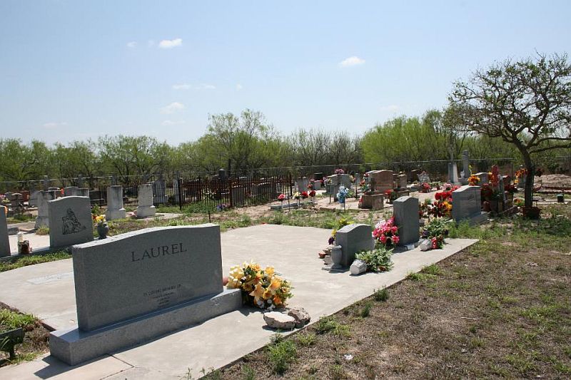
Taurino Laurel Memorial |
Saenz Lane |
Santa Anna |
26.40.19.730 N |
98.31.52.295 W |
|
|
Driving Directions: From FM 2294/FM 755 junction, go 6.4
miles north on FM 755. Turn right at Saenz Ln., and go 2.1
miles east northeast, through two gates, to first fork.
At fork go left approx. 0.3 mile. At second fork turn right,
cross cattle guard, and go 0.1 mile. At third fork Stay
right and go 0.2 mile. At fourth fork, say left and go 0.3
mile north-west-south. Go through gate on right (west) side
of road and follow pipeline approx. 0.15 mile (806 ft.)
northwest (will go through two unlocked gates). Turn left
at dim road and go 0.08 mile (423 ft.) west to cemetery.
The cemetery is not a map feature, and there are no cemetery
signs posted. The cemetery is located in a very remote area,
on private property. It is fully fenced, maintained, and
active. When this survey was conducted, there were two marked
graves and a plot reserved for the wife of Taurino Laurel.
Cemetery features include a flag pole, bronze veteran's
marker, an ornamental Steel fence that encloses a child's
grave, a double concrete marker with glass covered "nichos",
and a entry arch with cemetery name. |
|
Trevino |
Old El Sauz Rd, Galveston St |
Rio Grande City |
26.23.16.260 N |
98.50.42.011 W |
|
|
Driving Directions: From US 83 in Rio Grande City, go 0.7
mile north on Charco Blanco Rd. Turn left at W. Houston
St. and go 0.2 mile west. Turn left at Old El Sauz St.,
and then turn immediately right onto unpaved, unnamed road
between two large brick houses (this road is directly across
from Galveston St./Old El Sauz intersection.). Follow this
road approx. 0.1 mile west to cemetery. The cemetery is
moderately endangered. It is not a map feature, and it is
not accessible from a public road. There are no cemetery
signs posted. The cemetery is not fenced, but it is maintained.
There are two marked graves and possibly some unmarked.
The cemetery appears to be regularly visited. The cemetery
is primarily threatened by residential development. When
this survey was conducted, houses were being constructed
in the vicinity of the cemetery, and a new school had been
constructed nearby. |
|
Trevino |
Medanitos Road |
Santa Catarina |
26.39.18.349 N |
98.32.32.285 W |
|
|
Driving Directions: From FM 2294/FM 755 junction, go 5.0
miles north on FM 755. Turn right at Medanitos Rd. and go
2.5 miles east-northeast. Cemetery is approx. 240 ft. south
of road in cultivated field. The cemetery is not map feature,
and there are no cemetery signs posted. It is located in
a remote area, on a ranch. The cemetery is fully fenced,
maintained, and active, and it appears to regularly visited.
When this survey was conducted, the cemetery contained two
graves. The double headstone reads: Pedro Trevino Sept.
11, 1911 Jan. 30, 1995 Jesusita B. Aug. 1, 1912 Mar. 4,
2003 |
|
Uña de Gato |
Las Escobas Road |
Las Escobas Ranch |
26.42.05.000 N |
98.55.44.600 W |
 |
|
Depart El Sauz (N) for 5.6 miles. Turn left on Las Escobas
Road. Go 2.84 miles and keep right on unnamed road. Drive
3.23 miles and keep left on unnamed road for .73 miles.
Cemetery is on the left and is fenced and well maintained. |
|
Unknown |
FM 1017 |
La
Gloria |
26.43.14.447 N |
98.29.56.728 W |
|
|
Driving Directions: From FM 755/FM 1017 junction in La Gloria,
go 1.3 miles east on FM 1017. Turn left at private, unnamed
road (the road has gate, but no lock) and go 0.1 mile north.
Road dead ends at cemetery. The cemetery is a map feature,
but not cemetery signs are posted. The cemetery is maintained,
fully fenced, and active, and it is accessible to the public.
Cemetery features include: formal and homemade grave markers,
concrete curbing, gravel covering, ceramic photos, and concrete
grave slabs. Some older concrete markers have been replaced
with new granite markers. The cemetery appears to be frequently
visited. |
|
Unknown |
FM 1017 |
San
Isidro |
26.42.17.667 N |
98.26.44.842 W |
|
|
Driving Directions: From FM 1017/FM 2294 junction in San
Isidro, go 0.8 mile west on FM 1017. Turn left onto gated,
private road and go approx. 0.5 mile south-east-south (there
will be a fork with a locked gate just southwest of house
on left, Stay to the left, following better road). At second
fork, turn left and then right just after (east of) fence
row (note: there is also a road just before the fence row,
do not turn here). Go 0.2 mile south to cemetery, which
will be on the right along fence row. The cemetery is highly
endangered. It is a map feature, but it is located in a
very remote area on private property and is not directly
accessible from a public road. There are no cemetery signs
posted. The cemetery is partly fenced, but sections have
fallen. The cemetery is not maintained. A single grave marker
consists of locally cast concrete cross with associated
concrete urn. No inscriptions were evident on the cross.
There may be more unmarked graves within the fenced enclosure.
However, none were evident. livestock graze freely within
the cemetery. |
|
Unknown |
Midway Cemetery |
Rio
Grande City |
26.22.24.600 N |
98.53.41.900 W |
|
|
Directions to cemetery: from intersection of US83 and FM3167
(west of Rio Grande City), travel west on US83 2.0 miles;
turn left (south) on Midway Road, travel south .4 miles;
turn right (west) on Midway Cemetery Road (unimproved),
travel .3 miles; cemetery on left (south) endangerment factors:
fenced, active. |
|
Unknown [may be Catholic
Cemetery] |
intersection of 6th Street and San Antonio Roads |
Rio Grande City |
26.23.01.900 N |
98.49.15.400 W |
|
|
Directions to cemetery: from intersection of Eisenhower
and San Antonio Roads (in Rio Grande City), travel south
on San Antonio Road .5 miles; turn right (west) on 6th St.;
cemetery on right (north) endangerment factors: fenced,
active, maintained. |
|
Unknown |
FM755 |
Santa Elena |
26.45.06.900 N |
98.29.37.500 W |
|
|
Directions to cemetery: from intersection of FM755 and FM1017
(in La Gloria), travel northwest on FM755 3.6 miles; cemetery
on left (north west) endangerment factors: fenced, active,
maintained. |
|
Unknown |
FM 1017, FM 755 |
La Gloria |
26.43.10.174 N |
98.31.13.394 W |
|
|
Driving Directions: From FM 755/FM 1017 junction in La Gloria,
go less than 0.1 mile east on FM 1017. The small cemetery
is on south side of road, across from La Gloria Post Office.
This is a small, private cemetery located on a major pubic
road. It is not a map feature, and there are no cemetery
signs posted. It is accessible to public. The cemetery is
fully fenced, maintained, and active. It is also frequently
visited. |
|
Unknown |
FM 755 |
La Gloria |
26.44.05.300 N |
98.30.28.800 W |
|
|
Directions to cemetery: at intersection of FM755 and FM1017
(in La Gloria), travel northwest on FM755 1/3 miles; cemetery
on right (southeast) endangerment factors: active, fenced,
maintained. |
|
Unknown |
Joseph Lopez Rd |
La
Gloria |
26.44.52.464 N |
98.31.59.927 W |
|
|
Driving Directions: From FM 755 in La Gloria, go 1.4 miles
west on FM 1017 W. Turn right at Joseph Lopez Rd. and go
1.8 miles north. Turn right at entrance to Sal Colorada
Ranch and go 0.5 mile to Ranch house. Continue through locked
gate and follow road, behind house, for approx. 0.5 mile
north and then west. Cemetery is on north side of road.
The cemetery is highly endangered. It is a map feature,
but it is located in a very remote area on private property.
It is fully fenced, but not maintained. There are no cemetery
signs posted. Cemetery features include: ceramic photographs,
unique Statuary, grave slabs, formal granite and marble
markers, locally cast and homemade concrete markers, ornate
hand-wrought Steel markers, metal funeral markers, and wooden
markers. Some older grave markers are fallen or leaning.
Many of the grave plots, including individual and family,
are enclosed with chain link, ornamental cast iron, or woven
wire fences. |
|
Unknown |
intersection of W. 1St St. and Garza St. |
Rio Grande City |
26.22.49.600 N |
98.49.27.400 W |
|
|
Directions to cemetery: at intersection of Flores St. (FM755)
and 2nd Street (in Rio Grande City), travel west on W.2nd
St. for .6 miles; cemetery on left (south) endangerment
factors: fenced, maintained, active. |
|
Unknown |
FM1017 |
La
Reforma |
26.41.57.000 N
|
98.24.01.200 W |
|
|
Directions to cemetery: from intersection of FM1017 and
FM2294 (near San Isidro), travel east/southeast on FM1017
2.1 miles; turn right/south onto unimproved/unnamed road,
travel south .1 miles; cemetery is 300 yards southeast (adjacent
to SR-C021) endangerment factors: fenced, active, maintained,
adjacent to USGS and TXDOT feature cemetery.
|
|
Unknown |
FM 649 |
El Sauz |
26.32.56.096 N |
98.54.03.546 W |
|
|
Driving Directions: From US 83 in Garceno, go 10.4 miles
north on FM 649. Fenced gravesite is approx. 93 ft. east
of FM 649 in field. The cemetery is not a map feature. It
is located on private property, behind a locked gate. However,
it is clearly visible from FM 649. The grave is fully fenced,
maintained, and frequently visited. There are no cemetery
signs posted. |
|
Unknown Joseph |
Lopez Rd |
La Gloria |
26.44.45.714 N |
98.32.15.796 W |
|
|
Driving Directions: From
FM 755 in La Gloria, go 1.4 miles west on FM 1017 W. Turn
right at Joseph Lopez Rd. and go 1.8 miles north. Turn right
at entrance to Sal Colorada Ranch and go 0.5 mile to locked
gate/cattle guard at Ranch house. Continue through locked
gate and turn immediately right, following dim road though
second gate, and across field for approx. 954 ft. (0.18
mile). Cemetery is on south side of dim road. This cemetery
is moderately endangered. It is a map feature, but it is
located in a remote area on private property. It is fully
fenced, and selected sections are regularly maintained.
There are no cemetery signs posted. Cemetery features include:
ceramic photographs, grave slabs, formal granite and marble
markers, locally cast and homemade concrete markers, metal
funeral markers, and wooden markers. One burial plot that
contains two graves is enclosed by an ornamental cast iron
fence. Some older grave markers are fallen, leaning, or
missing. An decorative arch with the name "Saenz"
has been erected over three graves near the cemetery entrance.
These graves are well maintained and visited frequently.
|
|
Villarreal |
Old San Isidro Rd |
San Isidro |
26.43.32.899 N |
98.26.58.299 W |
|
|
Driving Directions: From FM 1017/FM 2294 junction in San
Isidro, go 0.7 mile west on FM 1017. Turn right at Old San
Isidro Rd. and go 0.5 mile north. Turn left onto private,
unnamed road and go approx. 0.2 mile west northwest to fork.
At fork go left, through locked gate, approx. 0.1 mile west.
Cemetery is on south side of road. This is a well maintained,
fully fenced, active cemetery. It is not a map feature and
is located on private property. There are no cemetery signs
posted. |
The new brochure Rescuing a Historic Cemetery from
the Texas Historical Commission is now available online and provides
tips on how to Start researching cemetery records and conduct cemetery
surveys. The brochure also gives information about the RIP Guardian
program for neglected historic cemeteries and how to get additional
assistance for your project. To download the publication, visit
www.thc.State.tx.us, select "Cemeteries,"
then "RIP Guardian" and scroll down to the bottom for the
link to the PDF.
Return to Home Page

This
page was laSt updated on -01/01/2013
Compilation
Copyright 2004-Present
by
Linda Blum-Barton

|